

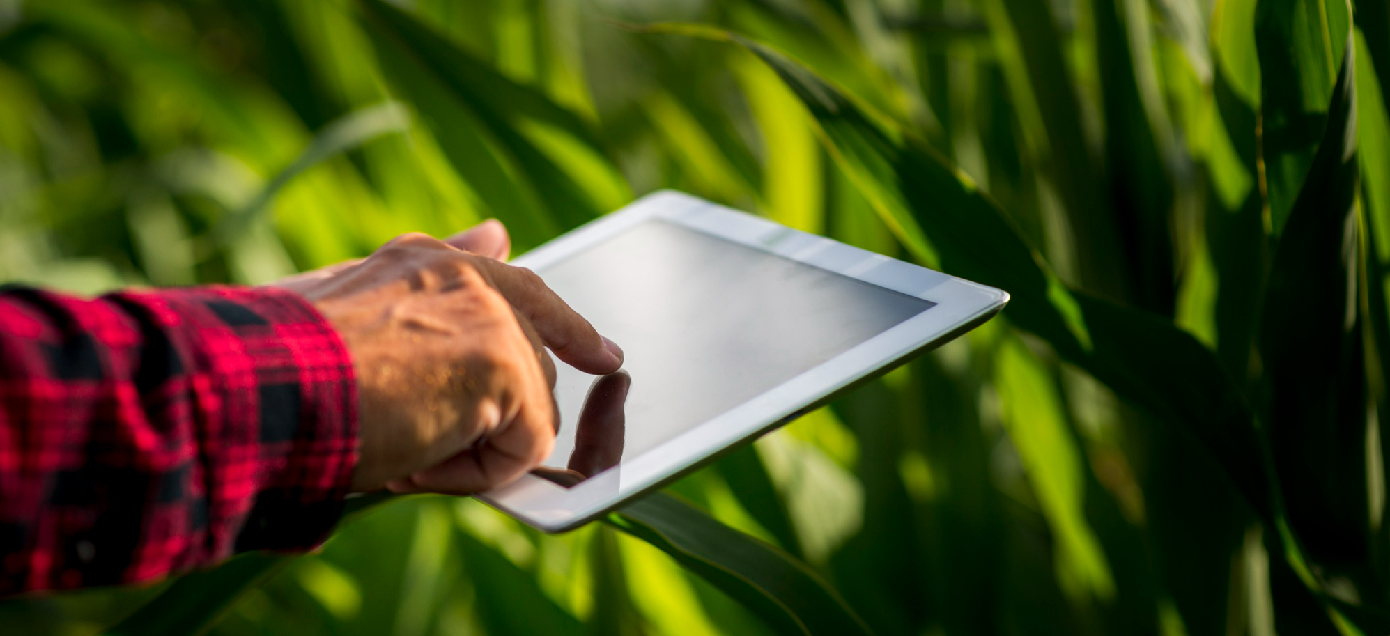
In unadorned words, remote sensing is the technology of measuring the characteristics of an object or surface from a distance.
The process is quite simple. Remote sensing requires an energy source, that can either be man-made (satellites for instance) or natural, like the sun. The light source in the atmosphere will interact with the target in a flow of information through a carrier, such as electromagnetic radiation, and then the energy transmitted will be recorded and processed by the sensor in the satellite and will require further interpretation and analysis to be converted into data.
Light is only recorded as data due to its nature as an electromagnetic wave, which makes it possible to measure the “amount” of light that an object reflects, and with that, obtain information on that object. HOW DOES IT HELP FARMERS?
 Now that the remote sensing process has been comprehended, it is important to recollect an essential
plant characteristic: chlorophyll. This compound is responsible for all the major metabolic functions in
every crop, by absorbing the light and transforming it into energy. So, it’s to be expected that the
healthier the plant, the more light chlorophyll will absorb, and this is the principle used to gather
information on crops through remote sensing.
Now that the remote sensing process has been comprehended, it is important to recollect an essential
plant characteristic: chlorophyll. This compound is responsible for all the major metabolic functions in
every crop, by absorbing the light and transforming it into energy. So, it’s to be expected that the
healthier the plant, the more light chlorophyll will absorb, and this is the principle used to gather
information on crops through remote sensing.
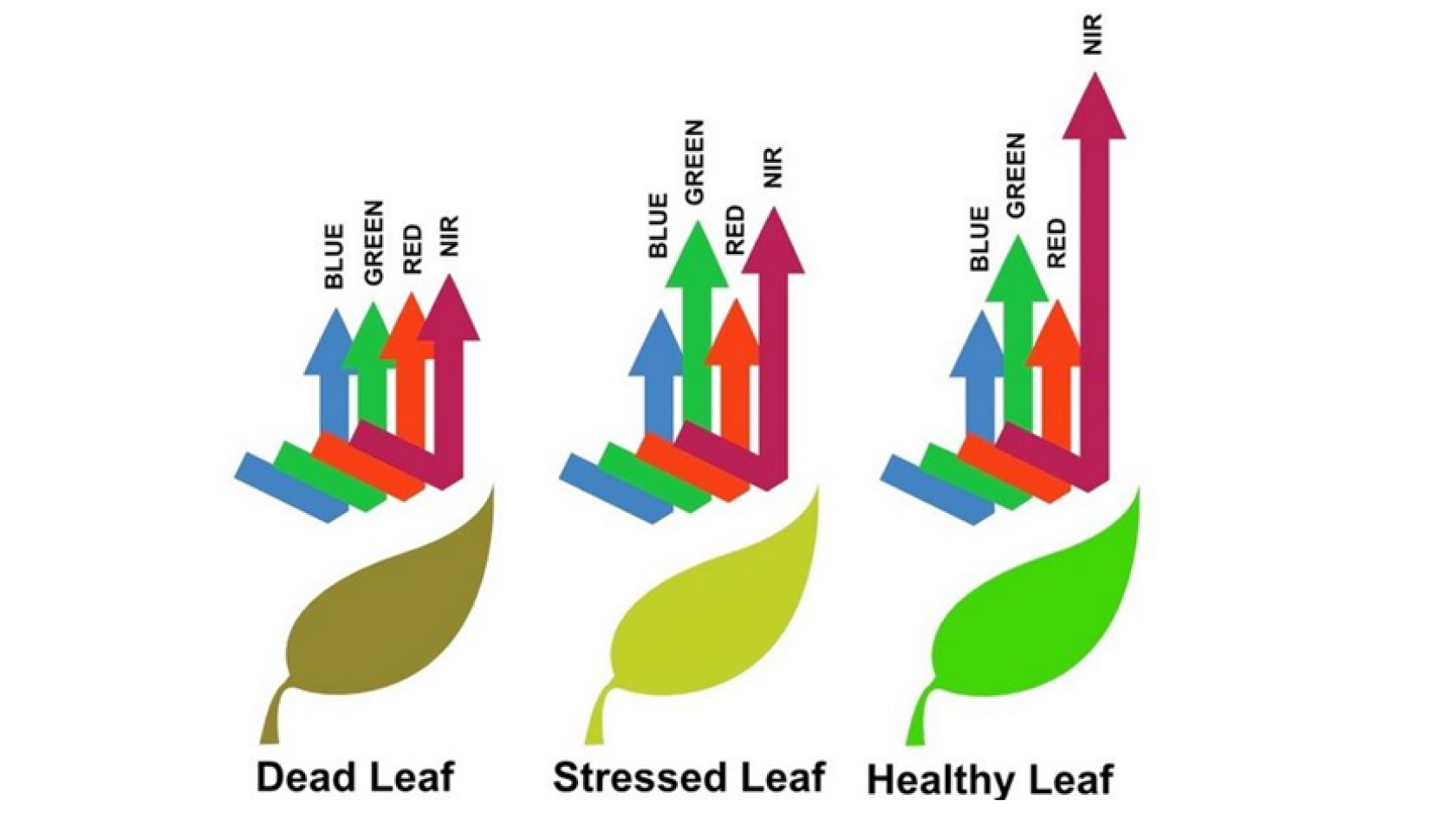
The thing is, there are different types of light, and not all of them are absorbed by the chlorophyll molecule. Light can be characterized by its wavelength, which is the measurement of the distance between one electromagnetic wave’s crest to another. Chlorophyll absorbs light in the red and blue wavelengths and reflects the infrared and green ones. Therefore, when a satellite records the energy transmitted back from a healthy crop after it is processed, it should show very little reflection in the red and blue wavelengths and a lot of energy reflected in green and infrared.
However, that is not always the result acquired. Any changes regarding plant materials, water content, pigment, nitrogen and carbon content will directly influence the data obtained since alterations in the plant’s biochemical compounds to have a big effect on light absorption and reflection.
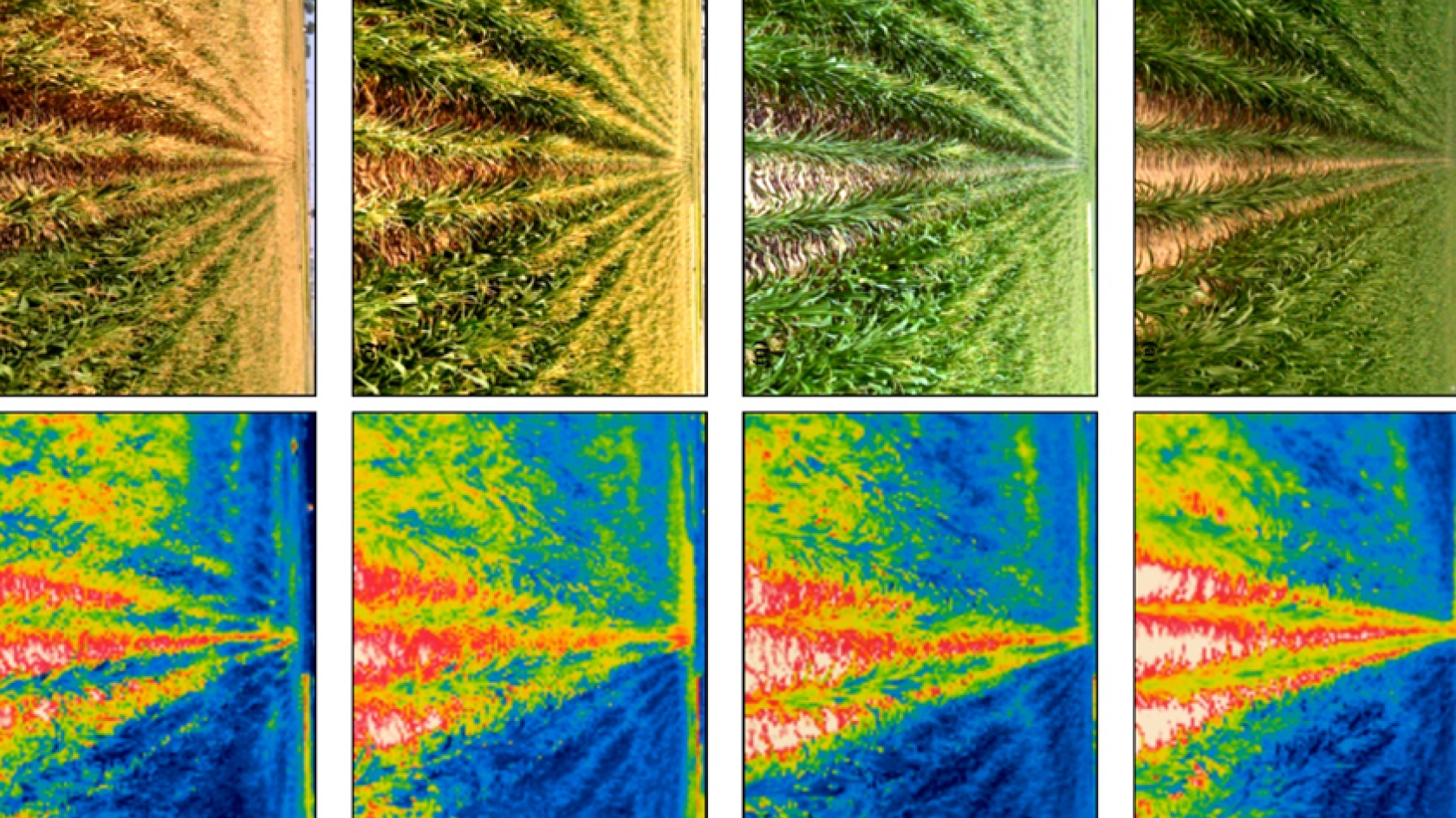
Measuring these variations, known as vegetation indices, provides the farmers meaningful information about the crop’s health, signs of environmental stress, water content and many other important characteristics. Moreover, when the wavelength that shows discrepancy is considered, the farmer can also know where the problem is located in the plant’s organism. For example, alteration in the visible region (that includes red, green and blue wavelengths) indicates chlorophyll issues. If it is in the near-infrared region, might be a sign of weakness of the cell structure, that can be caused by pests or diseases, yet if the variation happens in the shortwave infrared region, it suggests there could be something wrong with the crop’s water content, leaf biochemicals or protein and lignin levels.
Understanding the changes in the crop’s health throughout the field by remote sensing enables farmers to get fewer but extremely more precise soil and tissue samples to run analyses that, together with the i-Plant Nutrition and our satellite feature, can be interpreted from home, while empowering them to make rightful decisions by applying the correct amount of fertilizer according to the exact needs of each zone of the field, detecting pests before they cause severe damage and protecting the soil from the injury that fertilizer surplus might cause. Therefore, remote sensing in agriculture helps the farmers save money by reducing their fertilizer application costs, increasing productivity by taking corrective measures before there are visible signs of harm to the naked eye, and achieving higher yields by doing the right thing in the right place.